Last Updated on March 9, 2025
Estimated reading time: 18 minutes
By Jim Ferri
Ireland’s West Coast—from Killarney in the south up past Donegal in the north—encompasses some of the country’s most beautiful and dramatic landscapes. For many travelers, it is an iconic Ireland.
But it’s not just the landscape that makes this drive a favorite with travelers worldwide. The area is rich in history, culture, music, and, best of all, the welcoming nature of the Irish themselves.
I’ve visited Ireland’s west coast several times, yet I still feel myself being drawn back repeatedly. It’s just that intoxicating.
The best way to see Ireland’s West Coast is by car since it provides flexibility. There’s so much to do and see in a relatively small area. Plus, your vehicle will allow you to veer off the beaten path, which you’ll continuously want to do. You can also stay at less costly B&Bs and hotels outside popular tourist spots. If you haven’t taken a long road trip like this before, we can help you with the planning.
The best time to go is in the spring or fall when the weather is still good and the summer crowds have dissipated.
Planning a Tour of Ireland’s West Coast By Car
A few years ago, the Irish Tourism folks craftily developed a tour of its entire west coast. Depending on your perspective, it begins (or ends) at the border with Northern Ireland in the north and just outside Cork in the south.
They baptized this 1,550+ mile (2500km) ribbon of the road, the “Wild Atlantic Way,” and signposted the entire drive. They also developed various materials to help travelers discover the little gems they’ll find all along the way.
Although the Wild Atlantic Way is worth following, few people will drive its entire length.
However, the tour outlined below will allow you to see the most iconic places on Ireland’s west coast. This tour starts in Killarney and its iconic Ring of Kerry (map) and ends north of Donegal.
First, Select Your Arrival Airport
If you’re flying into Ireland, you can choose two international airports: Dublin in the east or Shannon on Ireland’s west coast. I suggest renting your car at the airport to make things easier. Also, returning it to the same airport will save you money.
Shannon is an 80+-mile drive to Killarney, roughly a two-hour drive. However, after seeing Killarney and the Ring of Kerry, you’ll backtrack past Shannon to continue your drive. At the end of your trip to Donegal, if you return your rental to Shannon, the 169-mile- drive (272 km) will take about three hours. (While in the Shannon area, you may want to attend the Bunratty Castle Medieval Banquet. It’s a great evening of fun and food in a 15th-century castle.)
The 195-mile (315 km) trip from Dublin to Killarney takes approximately 3½ hours. The return trip from Donegal to Dublin, 135 miles (217 km), takes about three hours.
On each trip, you’ll be on well-maintained roads, giving you time to begin to get accustomed to driving on the left side of the road.
(Be aware that the times given below are only the estimated driving times. They do not consider the time you may spend visiting sites along the way.)
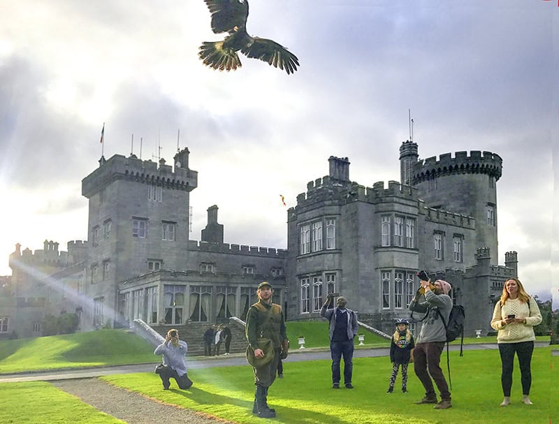
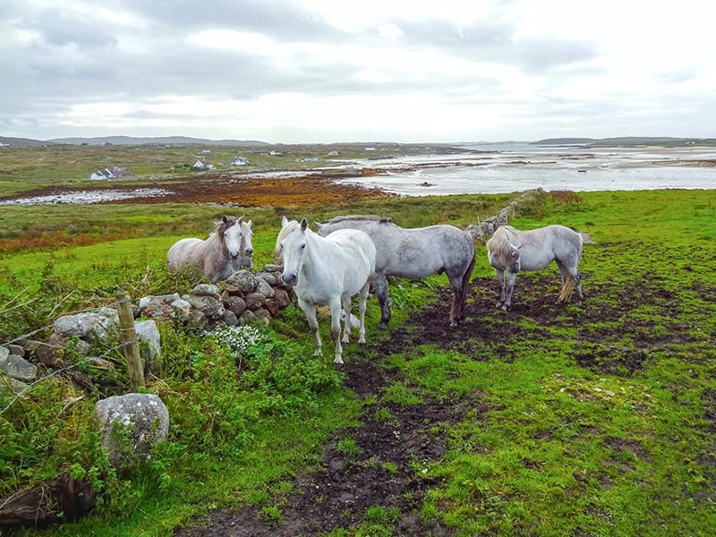
Day 1 and 2: Killarney and the Ring of Kerry
Ring of Kerry: 100 miles / approximately 5-6 hours
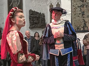
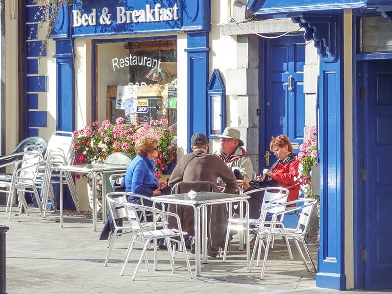
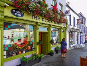
With its brightly painted buildings, flowers cascading almost everywhere, horse-drawn jaunting cars, and small-town charisma, Killarney oozes Irish charm.
The city’s many pubs are filled with locals and tourists who come for helpings of traditional Irish food, ale, music, and craic (Gaelic for a “good time”). In fact, you can walk down just about any street in Killarney, and you’ll find ample pubs and restaurants catering to both locals and visitors.
But despite its postcard-perfect appeal, the two reasons most travelers come to Killarney lie outside the town. The first is spectacular Killarney National Park; the second is the enthralling drive about the Ring of Kerry, a 100+ mile road around the Iveragh Peninsula jutting out into the Atlantic west of town.
Plan to spend two nights in Killarney. Spend your first day getting to know the city, perhaps taking a jaunting cart ride to the Muckross House in the National Park. You can spend the entire second day driving the Ring of Kerry.
Drive Counterclockwise
Some guidebooks tell you to drive clockwise to avoid the many tour buses clogging the road. It’s much better to go counterclockwise however, since setting off in the direction of Killorglin gives you a much better view.
I’ve done it several times. I have avoided the buses by setting out early, perhaps around 7–8 am. At that time, the buses haven’t even picked up their passengers yet.
Also, your trip will end in the National Park, so you’ll have time to drive about it a bit if you haven’t done so the previous day. Note that although the driving distance is only 100 miles, you’ll be moving slowly on the two-lane winding road. You’ll also stop often to take photos or pop into the charming little shops and restaurants you’ll pass along the way.
If You Go:
Killarney National Park
Admission: free; There is 24-hour pedestrian access to the park throughout the year except for Killarney House and Gardens (open 8.00am to 6.00pm daily).
Muckross House, Gardens, and Traditional Farms
Admission: €6 – 9
Day 3 on Ireland’s West Coast: Killarney to Dingle
65 miles (85 km) / one hour
The drive from Killarney to Dingle should only take one hour. I turned it into two by often stopping to admire the scenery on my circuitous route across the beautiful County Kerry countryside.
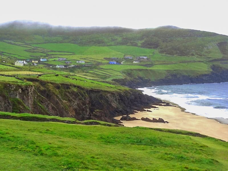
The town of Dingle is minuscule compared to Killarney, but that’s part of its charm. A little fishing port on a peninsula (smaller than the Ring of Kerry) jutting into the Atlantic, one of its attractions is its multi-colored buildings and laid-back atmosphere.
However, a far more significant attraction is its stunning scenery. In fact, the Dingle Peninsula showcases Ireland’s beauty.
The epic film Ryan’s Daughter was filmed on this peninsula, showing the world the beauty of Ireland, especially its west coast.
The Irish Examiner credited the film “with kick-starting Dingle, and indeed Irish, tourism through a three-hour international advert worth its weight in gold…” Go see for yourself.
To see this spectacular area, drive eastward from the town of Dingle to Slea Head. It was on the beach between Slea Head and Dunmore Head (Coumeenoole Beach), where the scenes were filmed.
Day 4: Dingle to Galway via Limerick and The Burren on the West Coast
236 miles (380 km) / 7 hours
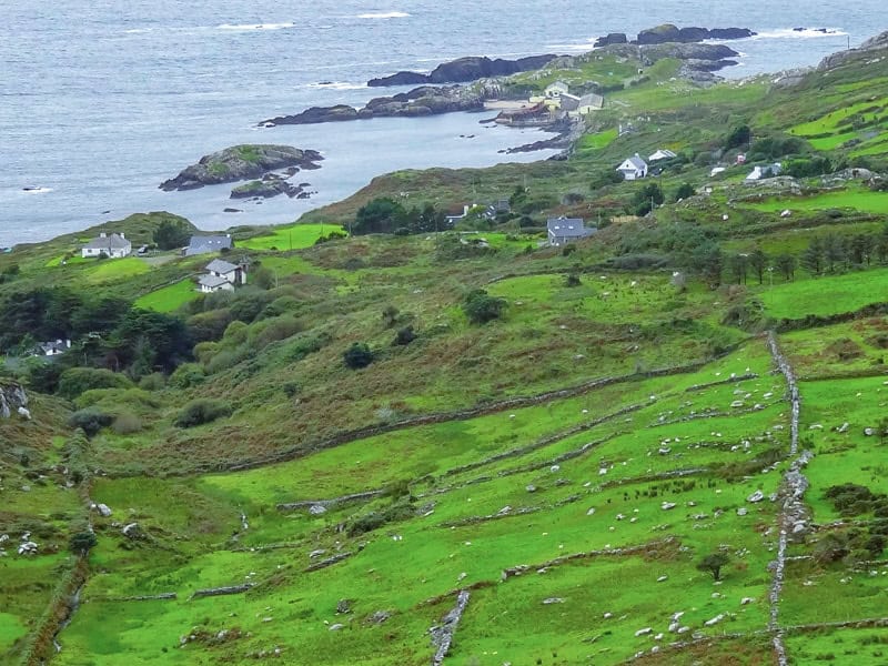
You’ll likely start your drive early today since it’s the longest stretch of the trip. But you’ll find it’s well worth it since The Burren is unlike any place else in Ireland. I was shocked when I saw it for the first time. It’s that different.
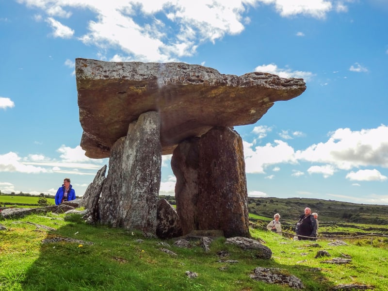
The Burren in County Clare, an area of almost 100 square miles, is a magical and mystical moonscape of Karst limestone. Ancient settlements, megalithic tombs, and beautiful flora and fauna are scattered about it.
Be sure to see the Poulnabrone Dolmen, one of Ireland’s most iconic archaeological monuments. It’s a 5,200–5,800-year-old “portal tomb” that contains the remains of 21 people. It’s the second-most visited place in The Burren.
The most visited place in the Burren is the sheer vertical Cliffs of Moher, which are 700 feet tall and 9 miles long. In ancient times, they were considered the end of the known world. Look out to sea from them today, and you’ll understand why.
On the edge of The Burren is the Multi-colored seaside village of Doolin, regarded as Ireland’s traditional music capital. If you enjoy caves, about two miles from the town, you’ll find Doolin Cave. Its claim to fame is a 23-foot stalactite, the largest in the northern hemisphere.
If You Go:
Cliffs of Moher
Admission: €4-8
Day 5: Galway – A Great City on Ireland’s West Coast
On Ireland’s West Coast, where the River Corrib meets the North Atlantic, you’ll find Galway. It’s a lively city, perhaps the most Irish town in Ireland.
Galway’s Old City is chockablock with pubs, shops, cheesemongers, restaurants, and everything else any proud Irish city should flaunt. It’s also colorful, with the shops and restaurants on its cobbled lanes a riot of reds, yellows, blues, and greens. Thanks to its young population, it retains a bohemian flavor.
There’s no denying that the city is charming, and you’ll find many things to do in and around the city. In fact, when you walk about the Old City, you get a sense you’ve peeked behind the curtain. Many old traditions survive in the area, even as they slowly ebb elsewhere.
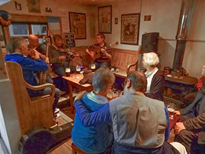
More than in the rest of Ireland, traditional Gaelic is still spoken among friends here. And traditional music wafts from its many crowded pubs in the evening. You can’t help but notice Galway’s vast wealth of street musicians, another tradition, with more here than in other cities.
If you’re there on Saturday, the farmers market adjacent to St. Nicholas’ Church will also have plenty of food and crafts.
A Side Trip to Clonmacnoise
(Clonmacnoise is 50 miles / 1 hour from Galway)
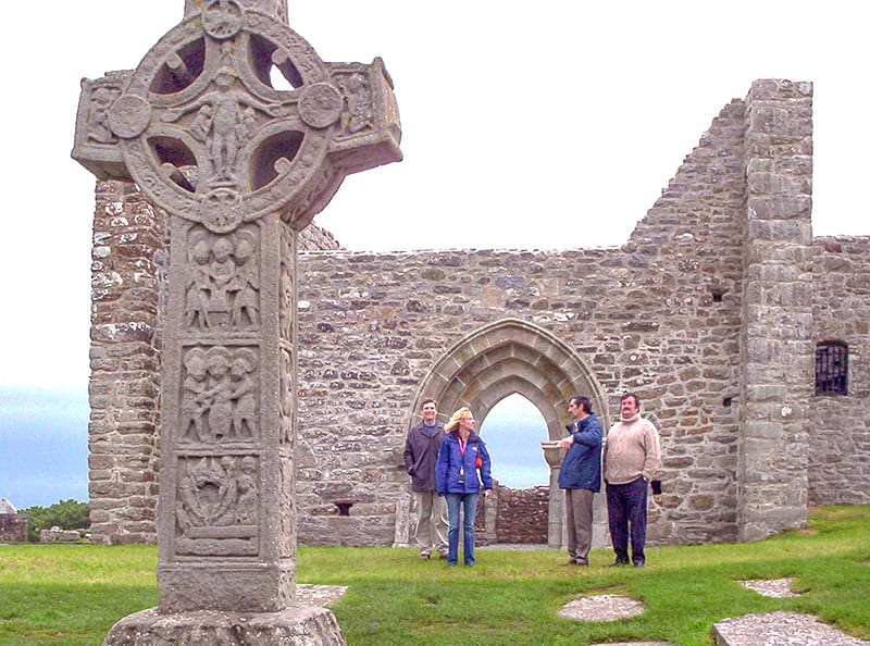
You can take a side trip from Galway to Clonmacnoise, Ireland’s foremost monastic city, which is now in ruins. Inside its ancient walls are remnants of a cathedral, seven small churches (called temples from the Gaelic “teampall”), towers, and early Christian grave slabs – the most in Western Europe.
Kids may find it boring, but adults interested in Ireland’s past will find it interesting. Be sure to see the audio-visual presentation in the museum first so you’ll understand what you’re viewing outside.
If You Go:
Clonmacnoise
Admission: €2-4 (must be purchased online)
Day 6 on Ireland’s West Coast: Galway to Clifden
48 miles (77 km) / 1½ hours
Spend the morning wandering about Galway, and in the midday, head off to Clifden, the Connemara region’s capital.
Clifden is a small city snuggled between the Atlantic and the Connemara Mountains, with few things to do and see. Many travelers, however, use it as a base for exploring Connemara. It was the perfect place to overnight before continuing my journey along Ireland’s west coast.
One historical place is a mile outside the city. There, you’ll see the spot where British aviators John Alcock and Arthur Brown ended their nonstop flight from Newfoundland, Canada, in June 1919. It was the first nonstop trans-Atlantic flight ever made.
They had been using the Marconi radio station near Clifden for navigation when they crashed landed in the adjacent bog. They survived and were knighted by King George V.
Day 7: Clifden to Kylemore Abbey and Westport
41 miles (66 km) / 1½ hours
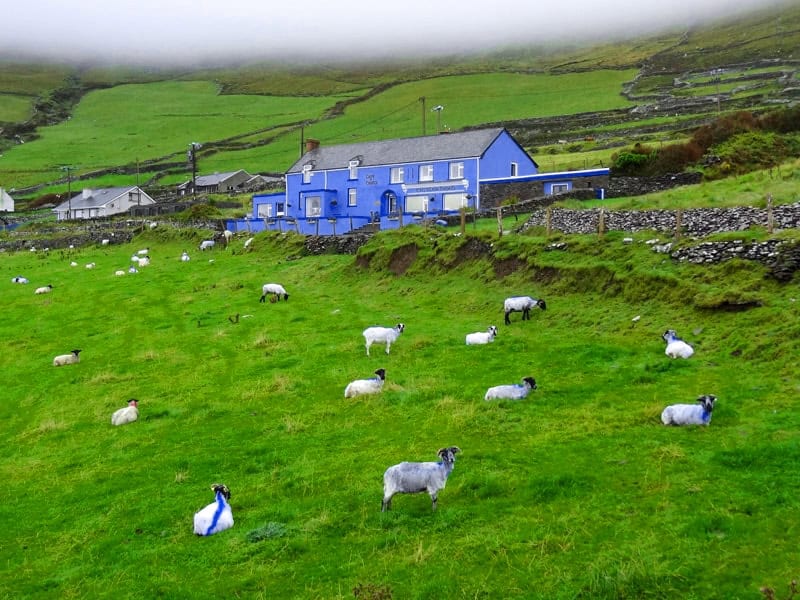
Once described by Oscar Wilde as “a savage beauty,” Connemara is a beautiful region of bogs, heaths, woodlands, and grasslands. It’s also the home of the Twelve Bens, the mountains that give the Connemara its unique character.
As you take the N59 to Westport, you’ll skirt the northern area of Connemara National Park, which is 7,400 acres (3,000 hectares). The road to the park’s visitor center is near the small village of Letterfrack. Admission is free.
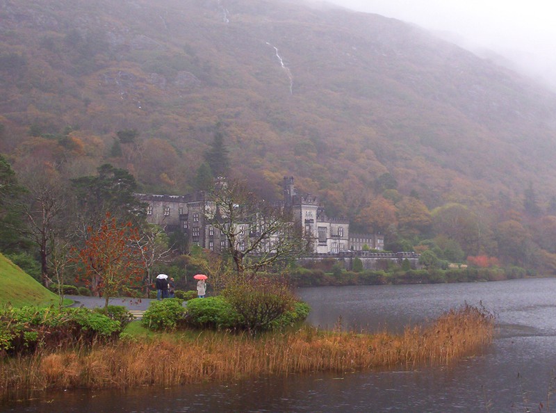
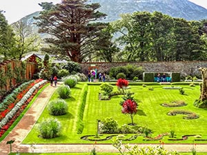
Less than 10 minutes down the road from the park, you’ll come to Kylemore Abbey, one of the most spectacular places you’ll find in Ireland. Originally a millionaire’s mansion, it has been the Sisters of the Benedictine Order’s home in Ireland since 1920.
In addition to the Gothic Revival castle, the highlight of Kylemore is its huge Victorian Walled Garden. The six-acre garden, divided into two by a mountain stream, only contains plant varieties from the Victorian era. Plan to spend time here touring the castle and walking about the gardens and woodlands. You’ll also find a craft and design shop and a restaurant.
Beguiling Westport
Continuing on the M59 up Ireland’s west coast, you’ll arrive in Westport in about an hour. Westport has tree-lined streets, eye-catching shops, and many restaurants and pubs, especially along charming Bridge Street.
The most famous of the pubs is Matt Molloy’s, named for and owned by the flutist of the Grammy-award-winning musical group The Chieftains. The Grammy sits behind the bar, and one time, when the bartender allowed me to hold it, I was surprised at how heavy it was. It’s a great pub suitable for all ages.
If You Go:
Kylemore Abbey & Victorian Walled Garden
Tel: +353 95 52001
Admission: €10 – 12.50
Matt Molloy’s
Bridge Street, Cahernamart
Westport, Co. Mayo
Tel: +353 98 26655
Day 8 on Ireland’s West Coast: Westport to Donegal
110 miles (166 km) 2½ hours
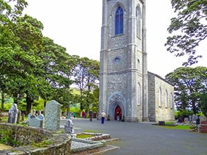
Head out of Westport on the N5 and follow the signs to Sligo, home of renowned poet William Butler Yeats. Continue through Sligo and pick up N15, heading to Drumcliff and Donegal. It’s about a 10-minute drive to Drumcliff, where you’ll find Yeats’ grave in the cemetery of the Drumcliff Church (also known as St Columba’s Church).
If you’re interested in Yeats, ask at the church for directions to Lissadell House and Gardens, where the poet is said to have received much of his inspiration. It’s only about a 10-minute ride along the shore of the bay.
Afterward, continue along the scenic N15 coastal road to Donegal, about a 45-minute drive from Drumcliff.
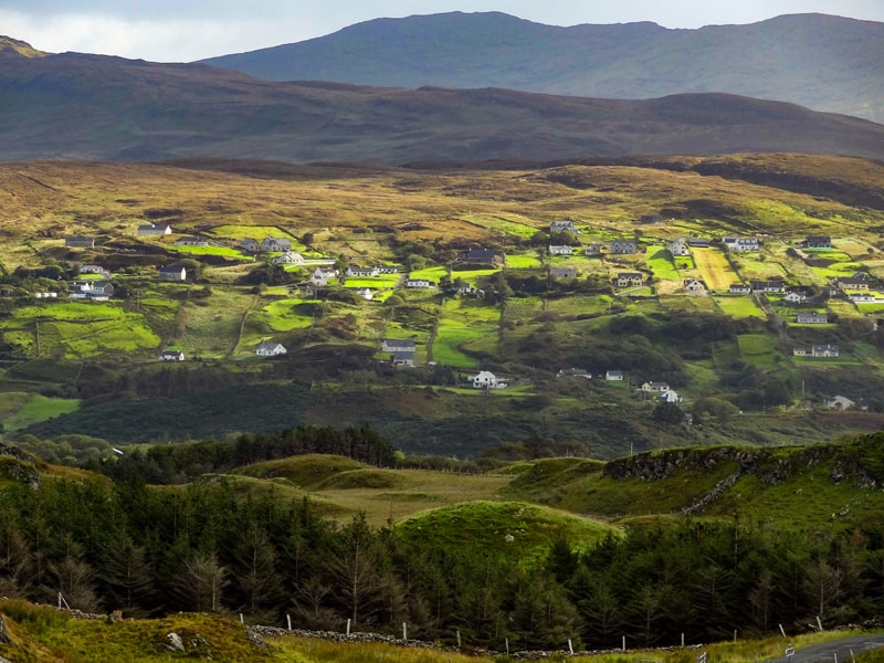
Tucked away in the northwest corner of Ireland, County Donegal doesn’t attract much attention. That’s one of the reasons I like it so much—it’s beautiful, green, and without the crowds.
The city of Donegal is a vest-pocket little town with a castle right in the middle of it. Just blocks away, steep hills meet the city’s edge, making it a pleasant Irish town to walk about.
There’s not a lot to see in Donegal town, and travelers mainly use it as a base for exploring the surrounding Donegal countryside.
One interesting place I found about five minutes out of town was the Donegal Craft Village. It’s a small art collective formed by a clutch of craftspeople, including a weaver, glassworker, sculptor, painter, etc. I found the variety, beauty, and quality of their work quite good and well worth stopping by to see.
If You Go:
Donegal Craft Village
Lurganboy
Donegal, F94 W9NY
Tel: +353 74 972 2225
Day 9 Slieve League – Glencolmcille – Donegal
80 miles (130 km) / 3 hours
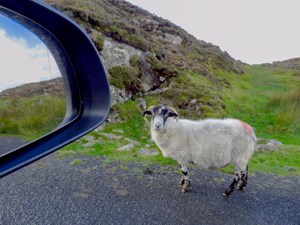
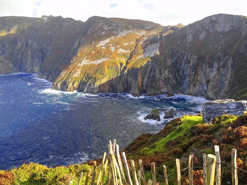
I had never heard of Slieve League until the owner of my B&B told me about it. He showed me on a map how to get there and told me to continue up the road by car rather than walking when I came to a gate. “Just remember to close the gate behind you so the sheep don’t get out,” he added.
It turned out that Slieve League is the highest cliff face in Europe. It’s not as famous as the Cliffs of Moher, but it’s three times higher. It’s beautiful and very dramatic.
You may also enjoy: The Dingle Peninsula, Showcasing Ireland’s Beauty / Ireland’s Ring of Kerry (With a Map) / Donegal, Ireland – The Charming, Rugged Northwest
To get there, drive east on the M56 through Donegal town and turn on R263 towards Killybegs, the largest fishing port in Ireland. Continue eastward on R263, and you’ll soon see signs for it.
In fact, all along the way, I was surprised at how well signposted it was, the best I’ve seen anywhere in Ireland. At every turn, there seemed to be a sign pointing me in the right direction.
Folk Village Museum
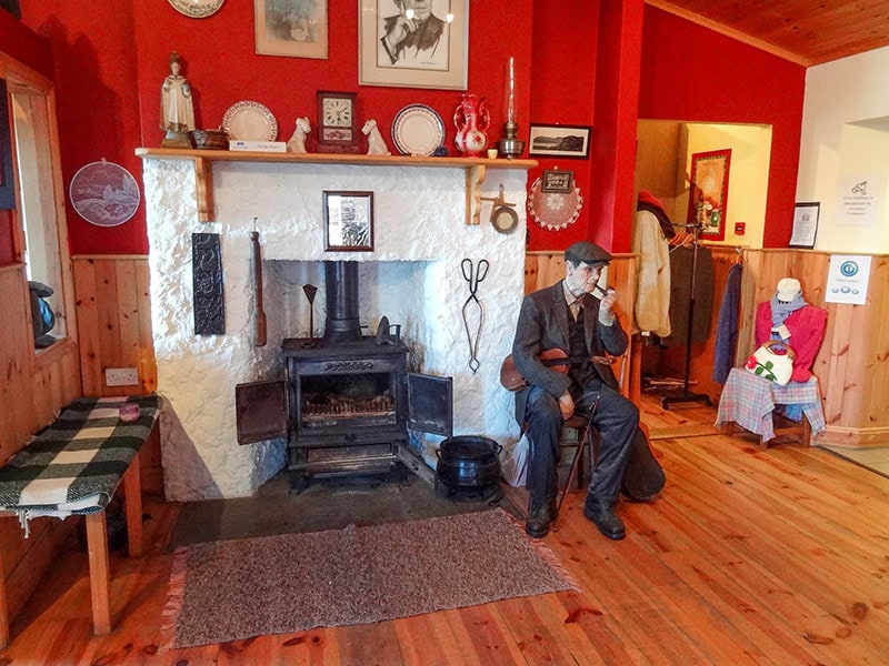
After seeing Slieve League, you must return to R263 (don’t forget to close the gate!). When you reach that road, turn left and follow the road towards the small town of Glencolmcille. Before you get to the town, however, you’ll come to the Folk Village Museum.
The Folk Village is a living history museum founded by a local priest in the 1960s to help the local economy. It’s fascinating as you can visit different cottages that portray life in the village in other centuries. It was a bit hokey when I first saw it, but it was very interesting. In fact, I wound up spending more time there than I thought I would.
Your return to Donegal on R263 will take you about an hour. Depending on the time of day, you may or may not want to overnight in Donegal.
The drive to Shannon or Dublin from Donegal should take three hours.
Leave a Reply